Share This Location


The Catharine Valley Trail follows the old Chemung Barge Canal towpath and sections of the abandoned Northern Central Rail lines, connecting the communities of Watkins Glen, Montour Falls, Millport, Pine Valley, and Horseheads.
Today, the existing trail is contiguous from downtown Watkins Glen to the Hamlet of Pine Valley. It’s a great natural corridor that utilizes compact stone dust paths that are an absolute pleasure to walk, bike, and ski. Note that the mileage given is one-way so unless visitors are enjoying the trail as a point-to-point excursion, the actual length will be double for out-and-back trips. Also note that the trail pitches downward from south to north so that, generally speaking, going northward you are headed downhill while southward you are climbing. However, the grade is very modest.
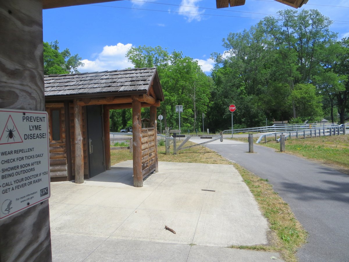
The trail is divided into sections between the various access points and sections that run through the villages. Most of the trail is within its own corridor but when the route passes through villages and shares public roads, the designated route is marked with small street signs.
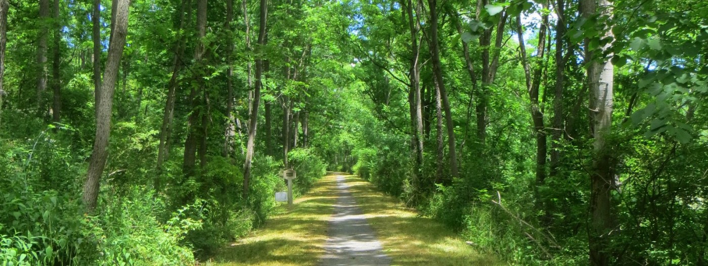
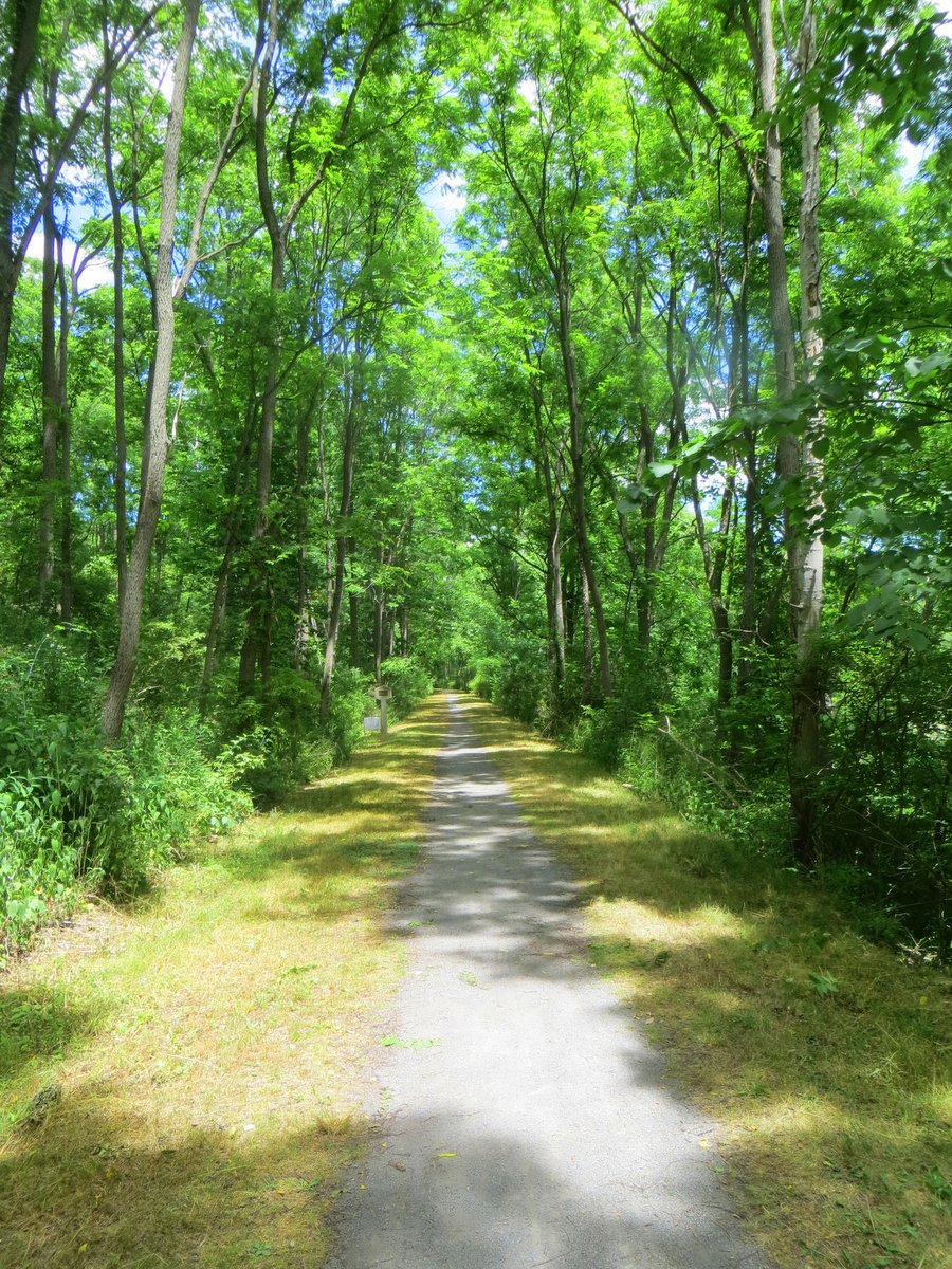
Stretches of the trail that run between towns delve into deep forest and are thoroughly shaded and simply serene. It’s as if you have your own personal wooded highway. The paths are wide enough to ride/walk two abreast and provide ample room for passing other trekkers. Along these natural corridors, mileage markers measure the distance between access points, and several benches are spaced along the path so travelers can pause and take in the sounds and sights of the natural area. The entire trail is ADA compliant though access to some sections is better than at others.
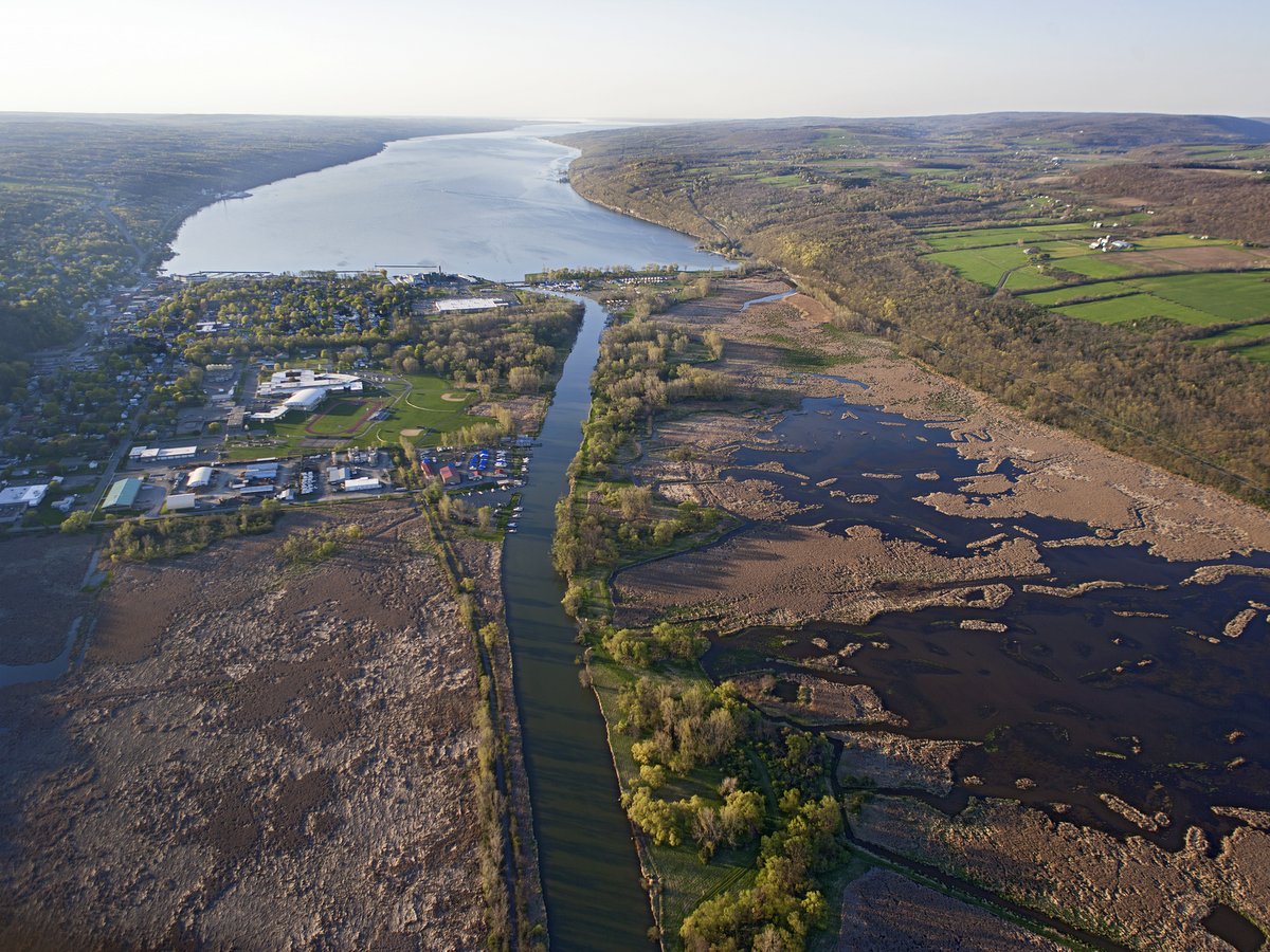
The corridor itself is well worth the trip, but nearby are several notable locations that outdoor enthusiasts will enjoy and should try to include in their excursion. First is the stunning gorge within Watkins Glen State Park. Second, and also nearby the village of Watkins Glen, is Queen Catharine Marsh which has foot trails accessible from the Catharine Valley Trail. The marsh has been identified as an Important Bird Area by the New York Audubon and with good reason. The marsh is one of only a few remaining headwater marshes in the Finger Lakes and lies along the Atlantic Flyway, an important east coast path for migratory birds. Third, though the route through the village of Montour Falls is mostly along public roads, trekkers should be aware of two nearby waterfalls: Aunt Sarah’s falls, 90 feet high and slightly north of the town, and She-Qua-Ga Falls (156 feet high) which can be viewed in a small park just off the trail route.
Following the wildly successful yet brief economic expansion that accompanied the completion of the Erie Canal, the Finger Lakes underwent an equally brief spurt of canal building. In Watkins Glen, a canal from Seneca Lake to the Chemung River was built to connect the Southern Tier to Seneca Lake.
Like the Erie Canal, the route was quickly supplanted by the railroads — in this case, the Northern Central Railroad. In kind, the advent of the automobile replaced the rail lines and soon these extensively engineered and robustly built corridors become abandoned. But in recent decades, repurposing these routes for recreation has brought new life to not only the fallow infrastructure but also the communities they connect. The bold plan to connect two state parks — Watkins Glen in the Finger Lakes and Mark Twain State Park in the Southern Tier — is a beautiful example of this rebirth.
Creating 14 miles of connective corridor through multiple townships, across county lines, through properties once dedicated to industry and commercial enterprise, as well as through private land, is an ambitious endeavor and one that has been a long time coming. The idea for connecting the two state parks is attributed to Ed Hoffman who advocated the multiuse trail and lead the effort in the 1990s to acquire properties along the abandoned Chemung Canal and Northern Central rail lines. These properties were gifted to New York State just before the new millennium and construction began in the decades following.
Since then, local and state governing agencies as well as private advocacy groups have all contributed to the process of making this vision a reality. Its effects are starting to show not only in a wonderfully beautiful natural corridor but also in stimulating local business along the route. The Catharine Valley Trail is a great example of a conservation effort that yields dividends for the natural world and the communities it connects.