Share This Location


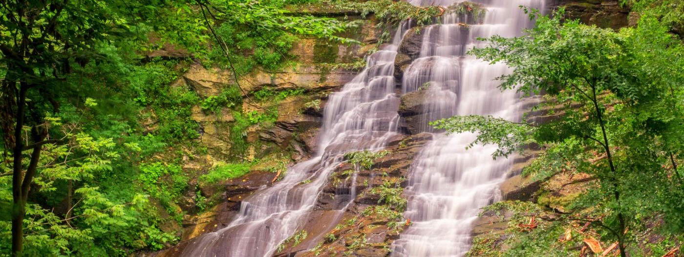
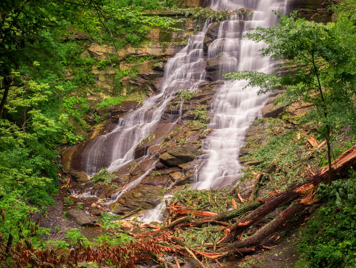
Pratt’s Falls County Park is small in size but not small in scenery. The staggering, 137-foot-high waterfall is clearly the sight to be seen within the roughly 300-acre park. The waterfall can be observed from an outlook near its crest, but you really need to view the falls from the base to take in its towering grandeur. The trail to the base is a short 0.6 miles and features steps and railings to ease the ascent/descent.
Back when New York was a part of a great inland sea, sediments deposited from the eroding mountains would disperse and settle on the seafloor. Over time, some sediment layers would form soft shale, while other layers would form erosion-resistant sandstone.
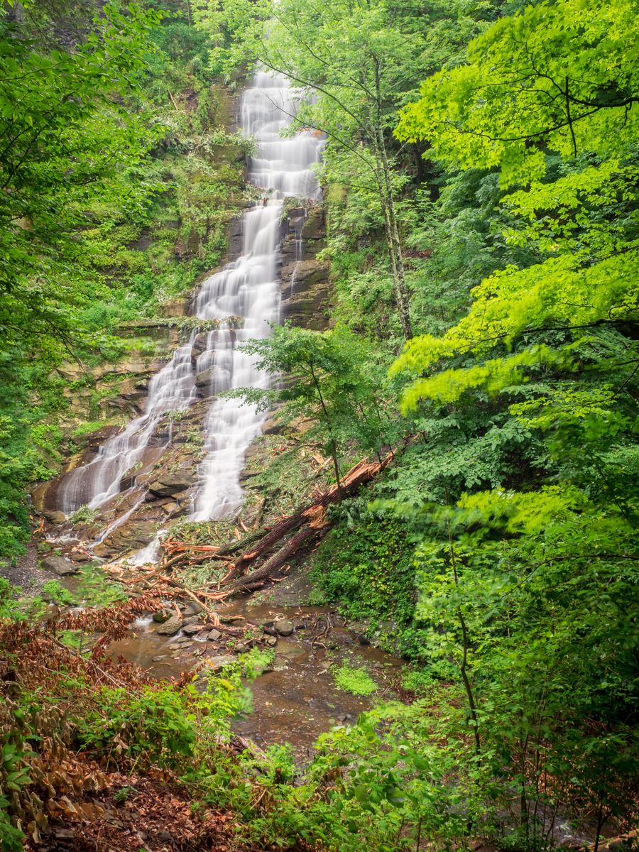
Later, when the land was uplifted and underwent the inevitable process of erosion once again, water along creeks and rivers would easily carve through the shale but more slowly through the sandstone layers. This interplay often results in staggeringly tall waterfalls and that is precisely what can be seen at Pratt’s Falls.
The falls are actually tiers of foaming cascades, as opposed to a single free-fall. Each tier is dozens of feet high, but so close in their vertical drops that the falls appear to be one frothy cascade. Since the crest — roughly 8 feet wide — is notably smaller than its fall — 137 feet — the falls are classified as a ribbon falls, one where the fall is at least twice as large as the width of the crest.
A small pond atop the falls was formed when Limestone Creek was previously dammed to power a sawmill when the area was first settled. The pond adds an easily accessible fishing spot but is also one of the reasons the waterfall has consistent volume throughout the year. When other waterfalls run dry in summer, Pratt’s Falls will likely still be flowing.
There are other trails in the park, but they mostly explore open fields and back up to the surrounding developments. Though good for exercise, the hardcore hiker will not find the additional 5 miles very isolated or remote. Hiking, archery, and dogs on a leash are all permitted in the park and though access is technically free, a $2 donation is requested.