Share This Location


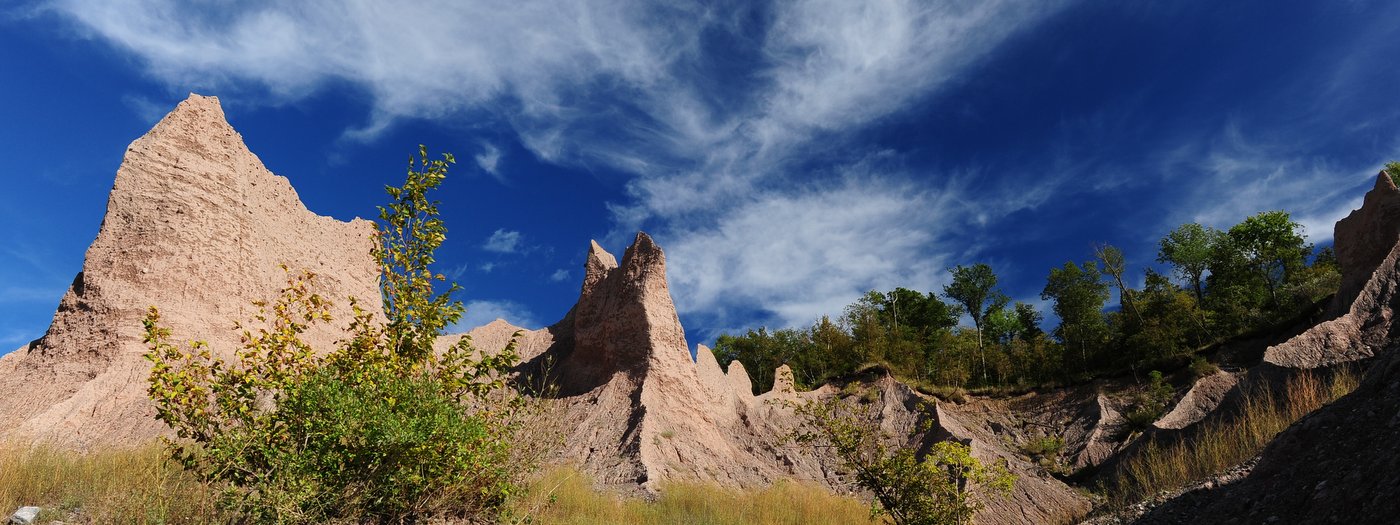
Upstate New York is often considered landlocked, but for outdoor enthusiasts hankering for a bit of an ocean feel, you can’t get much closer than the southern shores of Lake Ontario. If you are looking to complement the ocean feel with a hike and spectacular views, then head to Chimney Bluffs State Park and you won’t be disappointed. It is a perfect destination that encourages getting out and enjoying nature, even for less enthusiastic hikers who eschew the outdoors, complain about bugs, or recoil at the effort of a moderate climb. Why? Because the protests all disappear from memory when you reach the Bluff Trail’s crest and take in the towering chimney-like bluffs. The vast ocean-like lake, the earthen spire, and the tranquil woods all combine to provide a unique picturesque destination that leaves its visitors with an appetite for more adventure.

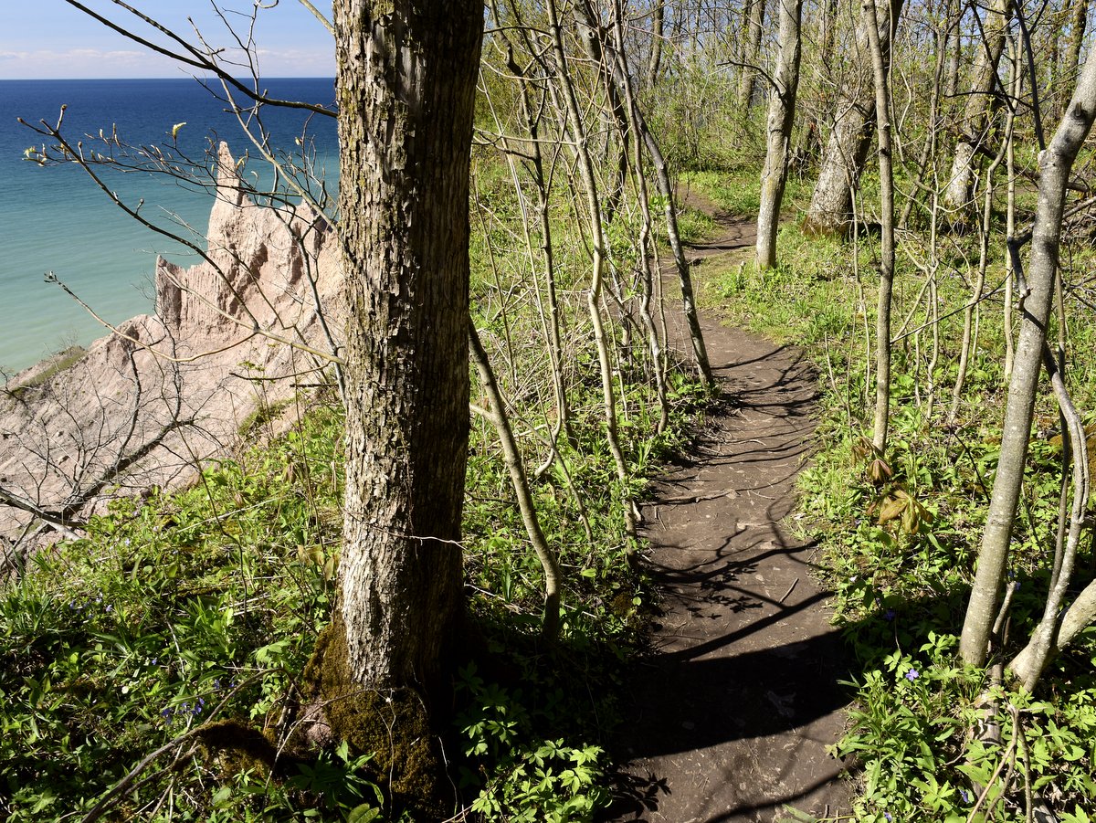
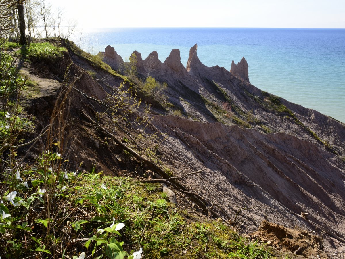
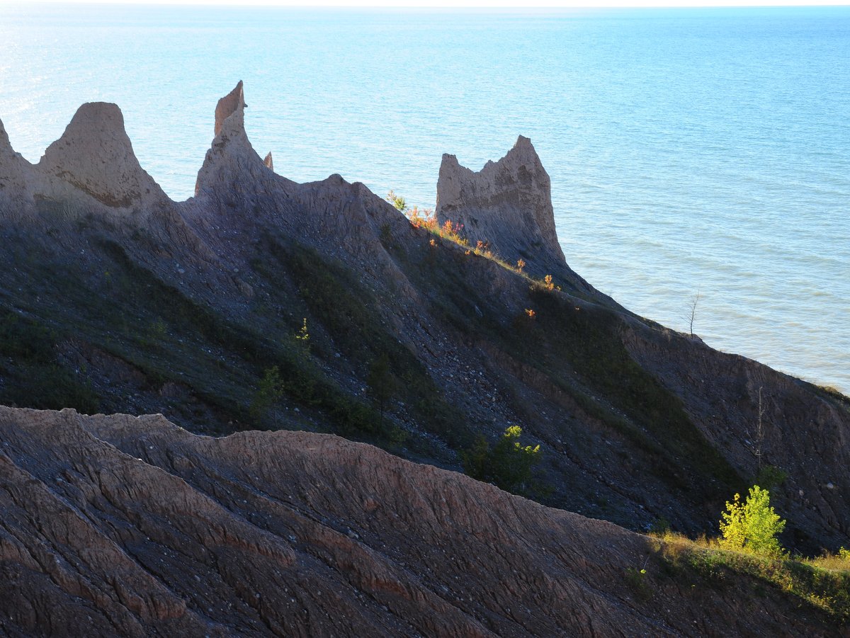
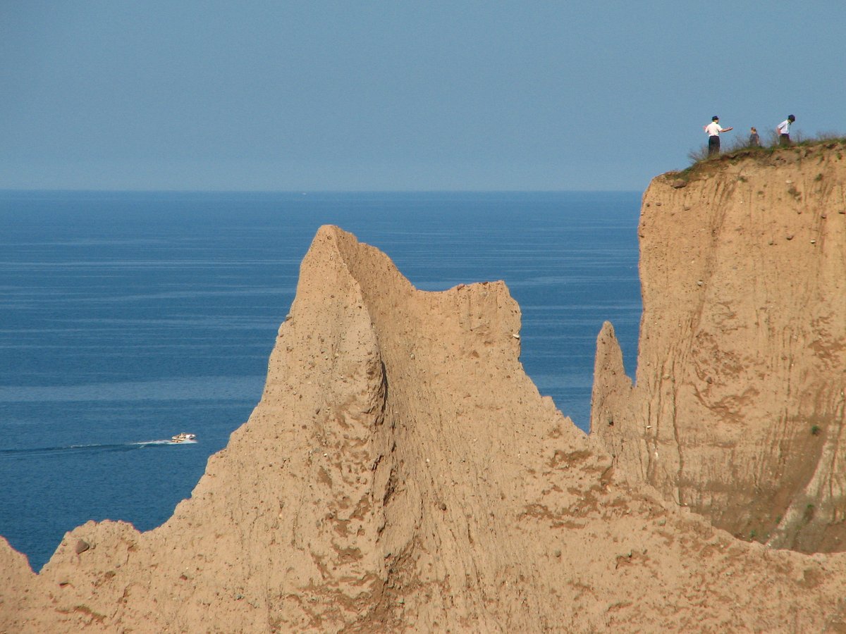
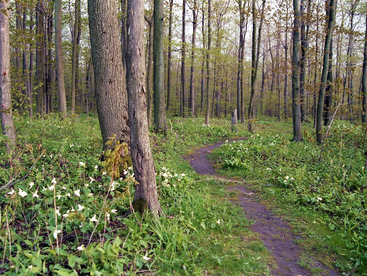
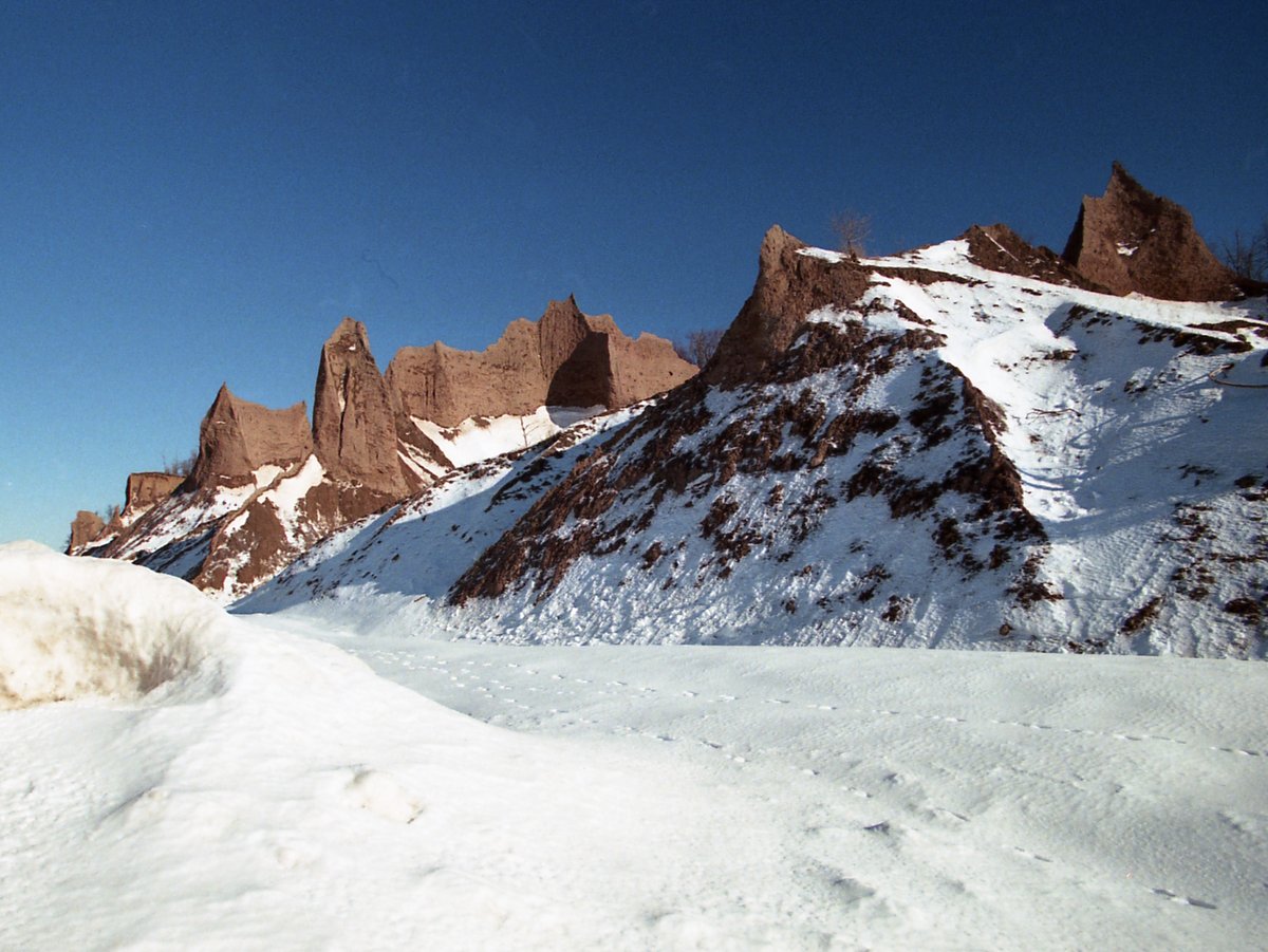
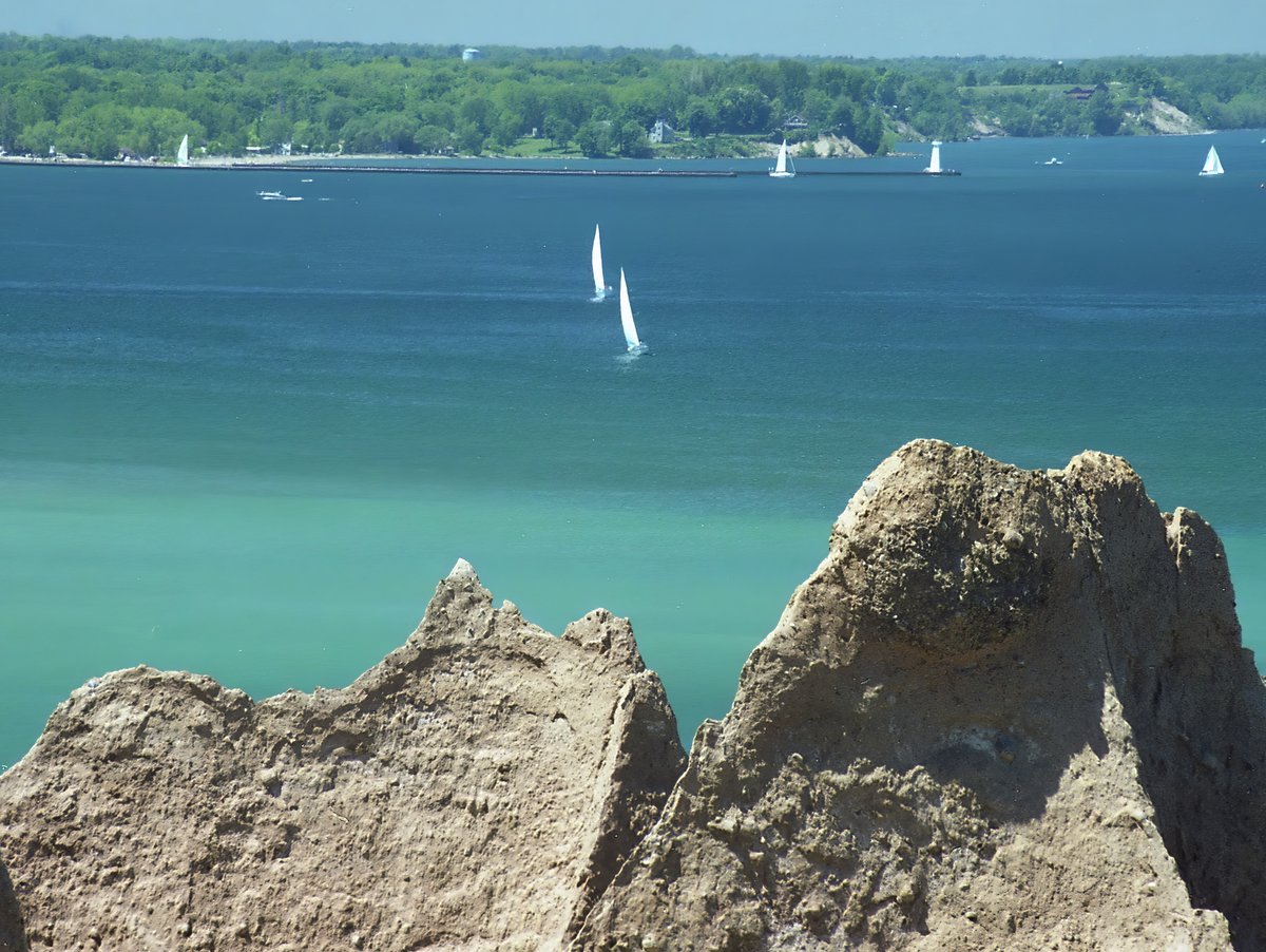
The park is nestled between Lake Ontario to the north and the Lake Shore Marshes Wildlife Area in practically every other direction. The neighboring wildlands and massive lake help provide a more remote feeling than the park’s 420 acres would imply. This feeling is enhanced by the fact that, unlike many state parks, there are a limited number of activities and facilities. There are restrooms, a few grill/picnic areas, a rocky beach, and hiking trails. Consider it more like a state forest with a few facilities than a typical state park, bustling with its varied audiences. The main attraction is of course the namesake bluffs which can be seen along the Bluff Trail and from below along the rocky beach. Ideally, you will want to view the bluffs from both perspectives.
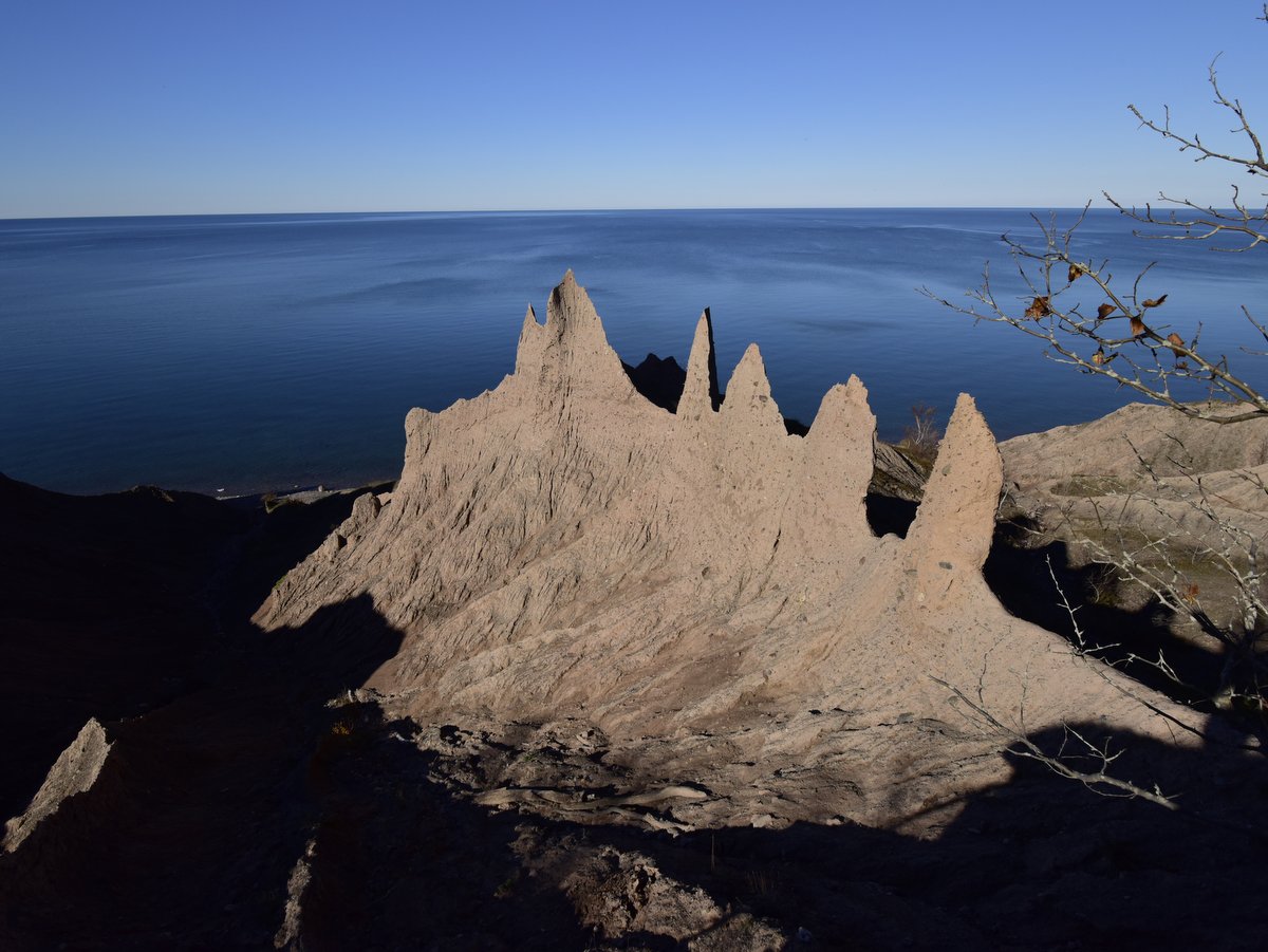
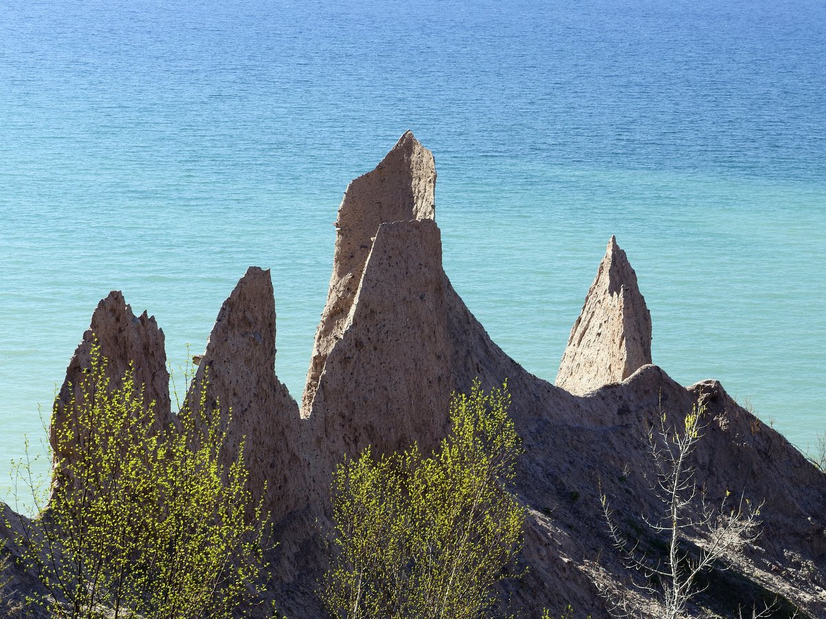
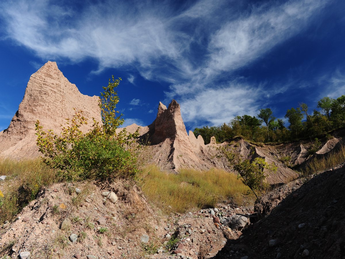
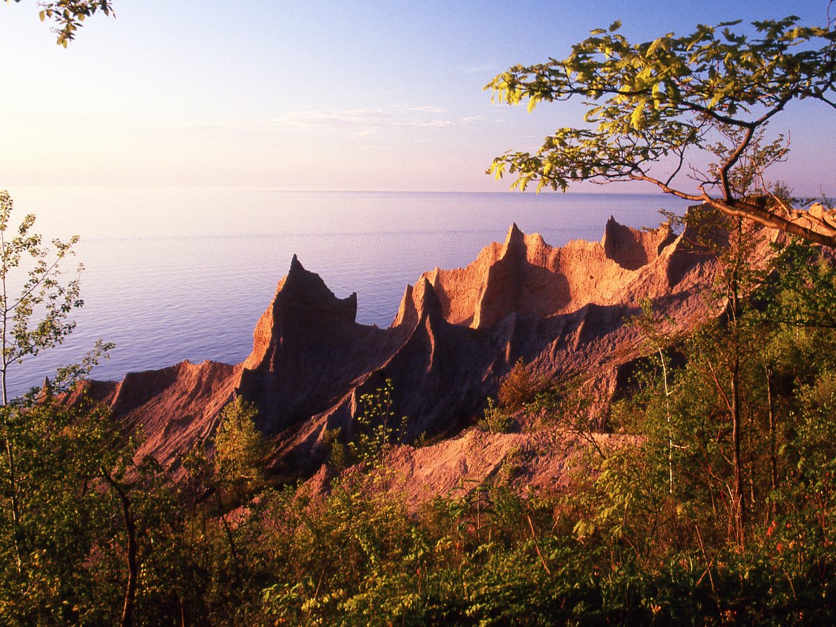
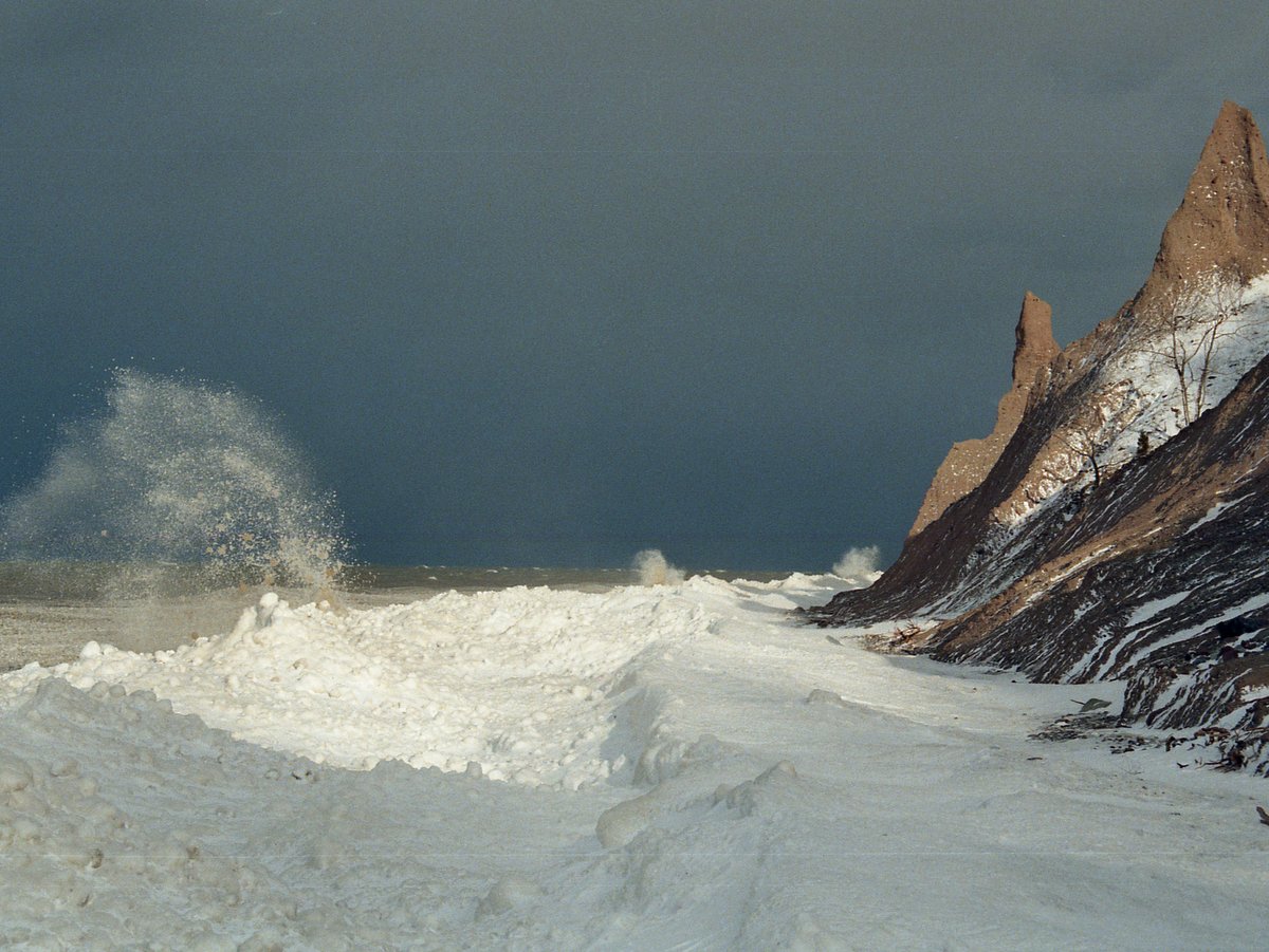
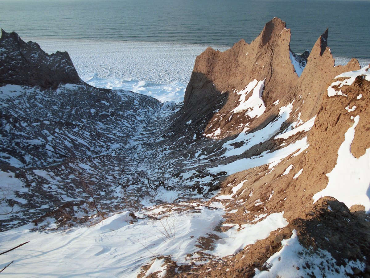
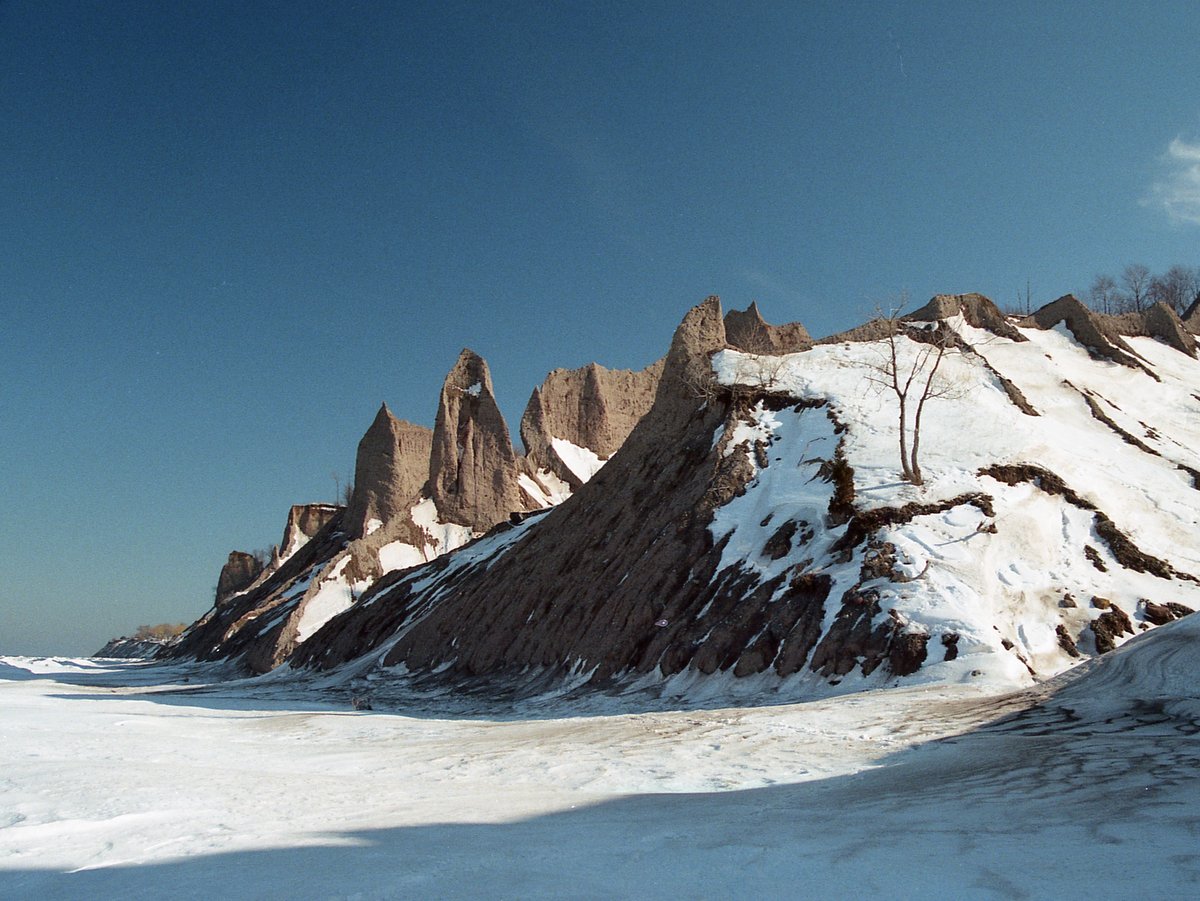
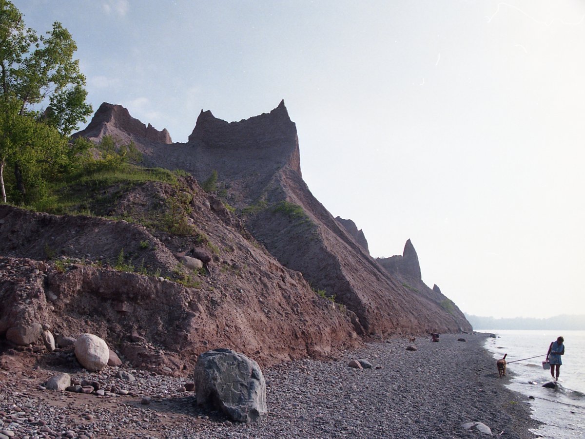
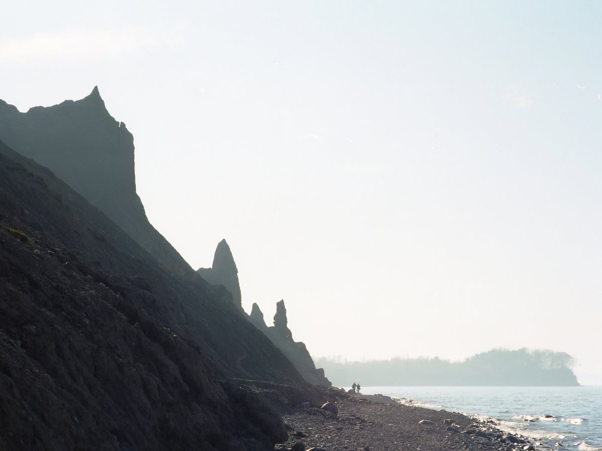
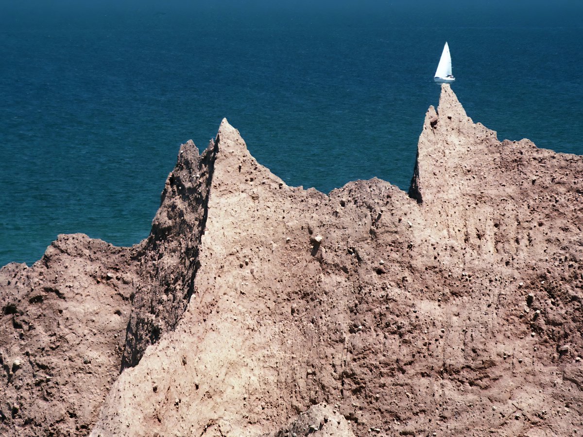
A bluff results when a drumlin is bisected and exposed to the forces of wind, waves, snow, and rain. As is the case across the Finger Lakes region, the land-sculpting power of the Laurentide Ice Sheet is powerfully evident here; the mile-high ice sheet created the drumlin. The exact process of drumlin formation is not fully understood, but drumlins are defined by elongated hills comprised of unsorted glacial till with a steep face towards the north and an elongated tail to the south. Elsewhere in the great drumlin field between Syracuse and Rochester, which contains an estimated 10,000 drumlins, the drumlins remain mostly intact and are shrouded by forests. Here the steep north face of the drumlin has been washed away by the Great Lake’s waves, which in turn provided the breach in the mound necessary for the erosional forces to begin their persistent onslaught. The peculiar effect here is that the unsorted till erodes unevenly; sandy portions are easily eroded while other sticky clay-like parts are not, resulting in towering organic spires that seem to defy gravity. The scene is simply spectacular with the immense waters of Lake Ontario as a background. With ongoing erosion, the view is always changing and so are trail conditions. Portions of the trail can be undercut, so use caution when approaching the unfenced edges, especially with kids and pets. It is prudent to check trail conditions on the state website before heading out.
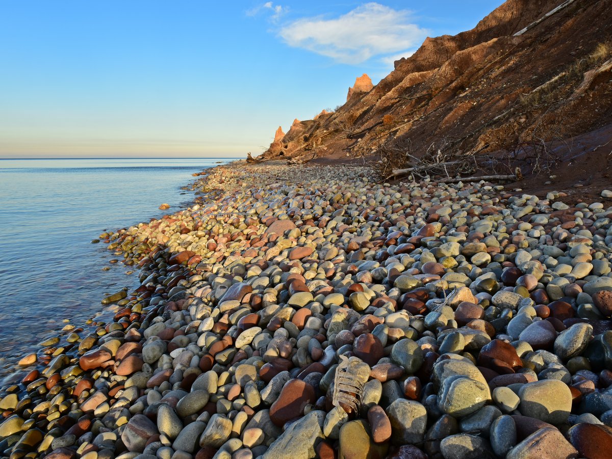
The nearly half-mile beach beneath the bluffs is the other main draw here. It is accessible on the eastern edge of the park either by way of a steep descent from the Bluff Trail or via the parking area along East Bay Road. The beach is mostly gravel mixed with cobblestones and a plethora of round smooth flat stones, which tempt you into breaking your stone-skipping record. With the seemingly endless lake before you and the towering bluffs behind, the setting is truly unique and a perfect spot to linger. Bank Swallows, who have turned the bluffs into a sort of aviary, will likely be dive-bombing and performing their aerial acrobatics overhead, further adding to the marvel. In the past, the bluff trail and lakeshore could be combined to form a loop, albeit one that required some scrambling. Now parts of the beach are entirely covered by an impassable tangle of blown-down trees and a loop is no longer possible.
There are two parking areas: one on Garner Road and a gravel pull-off close to the eastern end of the beach on East Bay Road. From April 1 to October 31, there is a vehicle entrance fee at the main gate. For those who want to extend their trip or add some mileage, there are two options: the East-West Trail and the Drumlin Trail which can provide a loop when combined with the Meadow and Bluff Trails.